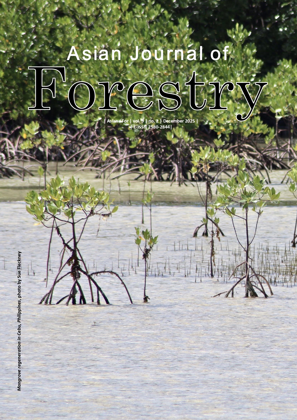
Estimating mangrove above-ground biomass using GEDI LiDAR, Sentinel data, and machine learning in Rawa Aopa National Park, Indonesia
Article Sidebar
Abstract Views: 615
File Views: 42
Main Article Content
Abstract
Abstract. Zulkarnain, Saleh MB, Purnomo H, Kuncahyo B, Tiryana T, Puspaningsih N. 2025. Estimating mangrove above-ground biomass using GEDI LiDAR, Sentinel data, and machine learning in Rawa Aopa National Park, Indonesia. Asian J For 9: 166-181. Accurate above-ground biomass estimation is crucial for climate change mitigation and sustainable mangrove management. Therefore, this study aimed to integrate Global Ecosystem Dynamics Investigation Light Detection and Ranging (GEDI LiDAR), Sentinel-1, and Sentinel-2, with field measurement data to estimate above-ground biomass in the mangrove forest of Rawa Aopa Watumohai National Park (RAWNP), Indonesia. Data processing was performed using Google Earth Engine, model training was conducted in Google Colab, and spatial analysis was performed with QGIS. Mangrove cover was mapped using Normalized Difference Moisture Index (NDMI) and Modified Normalized Difference Water Index (MNDWI) to estimate mangrove area in RAWNP. Furthermore, machine learning models, including Random Forest (RF), Gradient Boosting, Extreme Gradient Boosting, and Support Vector Regression, were developed and validated based on 30 field plots and 10-fold cross-validation. A total of 2,176 GEDI footprint points were used as reference data for model training. The results showed that RF outperformed the other model, with R²=0.46, Root Mean Square Error (RMSE)=72.52 during the evaluation stage and R²=0.69, RMSE=29.47 during validation. Multitemporal analysis (2019-2023) showed peak above-ground biomass density in 2021 at 148.94 tons ha-¹, followed by a decline. This study presents an effective approach for estimating and mapping above-ground biomass in the mangrove forest of RAWNP, and the resulting biomass maps can be used to support mangrove conservation strategies, REDD+ verification, and coastal ecosystem management in tropical protected areas.
Article Details
Issue
Section
How to Cite
References
Ahmed N, Glaser M. 2016. Coastal aquaculture, mangrove deforestation and blue carbon emissions: is REDD+ a solution? Mar Policy 66: 58-66. DOI: 10.1016/j.marpol.2016.01.011.
Alongi DM. 2020. Global significance of mangrove blue carbon in climate change mitigation. Sci 2 (3): 67. DOI: 10.3390/sci2030067.
Alvarez E, Duque A, Saldarriaga J, Cabrera K, de las Salas G, del Valle I, Lema A, Moreno F, Orrego S, Rodríguez L. 2012. Tree above-ground biomass allometries for carbon stocks estimation in the natural forests of Colombia. For Ecol Manag 267: 297-308. DOI: 10.1016/j.foreco.2011.12.013.
Argamosa RJL, Blanco AC, Baloloy AB, Candido CG, Dumalag JBLC, Dimapilis LLC, Paringit EC. 2018. Modelling above-ground biomass of mangrove forest using Sentinel-1 imagery. ISPRS Ann Photogramm Remote Sens Spat Inf Sci IV 3 (3): 13-20. DOI: 10.5194/isprs-annals-IV-3-13-2018.
Arifanti VB, Kauffman JB, Subarno JB, Ilman M, Tosiani A, Novita N. 2022. Contributions of mangrove conservation and restoration to climate change mitigation in Indonesia. Glob Chang Biol 28 (15): 4523-4538. DOI: 10.1111/gcb.16216.
Askar, Nuthammachot N, Phairuang W, Wicaksono P, Sayektiningsih T. 2018. Estimating above-ground biomass on private forest using Sentinel-2 imagery. J Sens 2018: 6745629. DOI: 10.1155/2018/6745629.
Bai J, Meng Y, Gou R, Lyu J, Dai Z, Diao X, Zhang H, Luo Y, Zhu X, Lin G. 2021. Mangrove diversity enhances plant biomass production and carbon storage in Hainan Island, China. Funct Ecol 35 (3): 774-786. DOI: 10.1111/1365-2435.13753.
Bao HD, Huong NTT. 2025. Estimating forest above ground biomass in Dak Lak Province, Vietnam. Asian J For 9 (1): 115-123. DOI: 10.13057/asianjfor/r090112.
Bezerra E, Mafalda S, Alvarez AB, Uman-Flores DA, Perez-Torres WI, Palomino-Quispe F. 2023. A cloud coverage image reconstruction approach for remote sensing of temperature and vegetation in Amazon rainforest. Appl Sci 13 (23): 12900. DOI: 10.3390/app132312900.
Bruening JM, Fischer R, Bohn FJ, Armston J, Armstrong AH, Knapp N, Tang H, Huth A, Dubayah R. 2021. Challenges to above-ground biomass prediction from waveform LiDAR. Environ Res Lett 16 (12): 125013. DOI: 10.1088/1748-9326/ac3cec.
Bryan-Brown DN, Connolly RM, Richards DR, Adame F, Friess DA, Brown CJ. 2020. Global trends in mangrove forest fragmentation. Sci Rep 10 (1): 7117. DOI: 10.1038/s41598-020-63880-1.
Budiman F. 2019. SVM-RBF parameters testing optimization using cross validation and grid search to improve multiclass classification. Sci Vis 11 (1): 80-90. DOI: 10.26583/sv.11.1.07.
Budiman I, Mubarak A, Kapita S, Abdullah SD, Salmin M. 2021. Implementation of backpropagation artificial network methods for early children's intelligence prediction. E3S Web Conf 328 04033. DOI: 10.1051/e3sconf/202132804033.
Bullock EL, Healey SP, Yang Z, Acosta R, Villalba H, Insfrán KP, Melo JB, Wilson S, Duncanson L, Næsset E, Armston J, Saarela S, Ståhl G, Patterson PL, Dubayah R. 2023. Estimating above-ground biomass density using hybrid statistical inference with GEDI LiDAR data and Paraguay's National Forest Inventory. Environ Res Lett 18 (8): 085001. DOI: 10.1088/1748-9326/acdf03.
Bunting P, Rosenqvist A, Hilarides L, Lucas RM, Thomas N, Tadono T, Worthington TA, Spalding M, Murray NJ, Rebelo LM. 2022. Global mangrove extent change 1996-2020: Global mangrove. Remote Sens 14 (15): 3657. DOI: 10.3390/rs14153657.
Cameron C, Hutley LB, Friess DA, Brown B. 2019. Community structure dynamics and carbon stock change of rehabilitated mangrove forests in Sulawesi, Indonesia. Ecol Appl 29 (1): e01810. DOI: 10.1002/eap.1810.
Carugati L, Gatto B, Rastelli E, Lo Martire M, Coral C, Greco S, Danovaro R. 2018. Impact of mangrove forests degradation on biodiversity and ecosystem functioning. Sci Rep 8 (1): 13298. DOI: 10.1038/s41598-018-31683-0.
Chave J, Andalo C, Brown S, Cairns MA, Chambers JQ, Eamus D, Fölster H, Fromard F, Higuchi N, Kira T, Lescure JP, Nelson BW, Ogawa H, Puig H, Riéra B, Yamakura T. 2005. Tree allometry and improved estimation of carbon stocks and balance in tropical forests. Oecologia 145 (1): 87-99. DOI: 10.1007/s00442-005-0100-x.
Chen S, Useya J, Mugiyo H. 2020. Decision-level fusion of Sentinel-1 SAR and Landsat 8 OLI texture features for crop discrimination and classification: Case of Masvingo, Zimbabwe. Heliyon 6 (11): e05358. DOI: 10.1016/j.heliyon.2020.e05358.
Coetzee C. 2022. Change detection of vegetation cover using remote sensing and GIS – a case study of the West Coast Region of South Africa. Geogr Environ Sustain 15 (2): 91-102. DOI: 10.24057/2071-9388-2021-067.
Devaney JL, Marone D, McElwain JC. 2021. Impact of soil salinity on mangrove restoration in a semiarid region: A case study from the Saloum Delta, Senegal. Restor Ecol 29 (2): e13186. DOI: 10.1111/rec.13186.
Dubayah R, Blair JB, Goetz S, Fatoyinbo L, Hansen M, Healey S, Hofton M, Hurtt G, Kellner J, Luthcke S, Armston J, Tang H, Duncanson L, Hancock S, Jantz P, Marselis S, Patterson PL, Qi W, Silva C. 2020. The global ecosystem dynamics investigation: High-resolution laser ranging of the Earth's forests and topography. Sci Remote Sens 1: 100002. DOI: 10.1016/j.srs.2020.100002.
Goodbody TRH, Coops NC, Queinnec M, White JC, Tompalski P, Hudak AT, Auty D, Valbuena R, LeBoeuf A, Sinclair I, McCartney G, Prieur J, Woods ME. 2023. sgsR?: A structurally guided sampling toolbox for LiDAR-based forest inventories. Forestry 96 (4): 411-424. DOI: 10.1093/forestry/cpac055.
Gouvêa LP, Serrão EA, Cavanaugh K, Gurgel CFD, Horta PA, Assis J. 2022. Global impacts of projected climate changes on the extent and above-ground biomass of mangrove forests. Divers Distrib 28 (11): 2349-2360. DOI: 10.1111/ddi.13631.
Gu Z, Cao M, Wang C, Yu N, Qing H. 2022. Research on mining maximum subsidence prediction based on genetic algorithm combined with XGBoost model. Sustainability 14 (16): 10421. DOI: 10.3390/su141610421.
Gupta R, Sharma LK. 2022. Above-ground biomass prediction by fusing GEDI footprints with optical and SAR data using the Random Forest in the mixed tropical forest, India. IEEE Intl Geosci Remote Sens Symp 2022: 5460-5463. DOI: 10.1109/IGARSS46834.2022.9883443.
Habibullah I, Sanjaya H, Putra ING. 2023. Utilization of the indices to detect and monitor the landcover changes of mangroves. IOP Conf Ser: Earth Environ Sci 1127 (1): 012033. DOI: 10.1088/1755-1315/1127/1/012033.
Hamuna B, Kalor JD, Tablaseray VE. 2019. The impact of tsunami on mangrove spatial change in eastern coastal of Biak Island, Indonesia. J Ecol Eng 20 (3): 1-6. DOI: 10.12911/22998993/95094.
Harris NL, Gibbs DA, Baccini A, Birdsey RA, de Bruin S, Farina M, Fatoyinbo L, Hansen MC, Herold M, Houghton RA, Potapov PV, Suarez DR, Roman-Cuesta RM, Saatchi SS, Slay CM, Turubanova SA, Tyukavina A. 2021. Global maps of twenty-first century forest carbon fluxes. Nat Clim Chang 11 (3): 234-240. DOI: 10.1038/s41558-020-00976-6.
Hernández-Stefanoni JL, Castillo-Santiago MÁ, Mas JF, Wheeler CE, Andres-Mauricio J, Tun-Dzul F, George-Chacón SP, Reyes-Palomeque G, Castellanos-Basto B, Vaca R, Dupuy JM. 2020. Improving above-ground biomass maps of tropical dry forests by integrating LiDAR, ALOS PALSAR, climate and field data. Carbon Balance Manag 15 (1): 15. DOI: 10.1186/s13021-020-00151-6.
Hickey SM, Radford B. 2022. Turning the tide on mapping marginal mangroves with multi-dimensional space–time remote sensing. Remote Sens 14 (14): 3365. DOI: 10.3390/rs14143365.
Hidayah Z, Utama RYS, As-Syakur AR, Rachman HA, Wiyanto DB. 2024. Mapping mangrove above-ground carbon stock of Benoa Bay, Bali using Sentinel-1 satellite imagery. IOP Conf Ser: Earth Environ Sci 1298 (1): 012013. DOI: 10.1088/1755-1315/1298/1/012013.
Hu H, Zhou H, Cao K, Lou W, Zhang G, Gu Q, Wang J. 2024. Biomass estimation of milk vetch using UAV hyperspectral imagery and machine learning. Remote Sens 16 (12): 2183. DOI: 10.3390/rs16122183.
Hu T, Zhang YY, Su Y, Zheng Y, Lin G, Guo Q. 2020. Mapping the global mangrove forest above-ground biomass using multi-source remote sensing data. Remote Sens 12 (10): 1690. DOI: 10.3390/rs12101690.
Huang AT, Gillett ZE, Taschetto AS. 2024. Australian rainfall increases during multi-year La Niña. Geophys Res Lett 51 (9): e2023GL106939. DOI: 10.1029/2023GL106939.
Indrayani E, Kalor JD, Warpur M, Hamuna B. 2021. Using allometric equations to estimate mangrove biomass and carbon stock in Demta Bay, Papua Province, Indonesia. J Ecol Eng 22 (5): 263-271. DOI: 10.12911/22998993/135945.
?spir DA. 2025. Spatiotemporal monitoring of the surface water level dynamics in Lake Tuz, Türkiye, using remote sensing and GIS. DYSONA: Appl Sci 6: 387-388. DOI: 10.30493/das.2025.506287.
Jantol N, Prikaziuk E, Celesti M, Hernandez-Sequeira I, Tomelleri E, Pacheco-Labrador J, Van Wittenberghe S, Pla F, Bandopadhyay S, Koren G, Siegmann B, Legovi? T, Kutnjak H, Cendrero-Mateo MP. 2023. Using Sentinel-2-based metrics to characterize the spatial heterogeneity of FLEX sun-induced chlorophyll fluorescence on sub-pixel scale. Remote Sens 15 (19): 4835. DOI: 10.3390/rs15194835.
Kacic P, Hirner A, Da Ponte E. 2021. Fusing Sentinel-1 and-2 to model GEDI-derived vegetation structure characteristics in GEE for the Paraguayan Chaco. Remote Sens 13 (24): 5105. DOI: 10.3390/rs13245105.
Kumar L, Mutanga O. 2018. Google Earth Engine applications since inception: Usage, trends, and potential. Remote Sens 10 (10): 1509. DOI: 10.3390/rs10101509.
Labriere N, Tao S, Chave J et al. 2018. In situ reference datasets from the TropiSAR and AfriSAR campaigns in support of upcoming spaceborne biomass missions. IEEE J Sel Top Appl Earth Observ Remote Sens 11 (10): 3617-3627. DOI: 10.1109/JSTARS.2018.2851606.
Lang N, Kalischek N, Armston J, Schindler K, Dubayah R, Wegner JD. 2022. Global canopy height regression and uncertainty estimation from GEDI LiDAR waveforms with deep ensembles. Remote Sens Environ 268 (October 2021), 112760. DOI: 10.1016/j.rse.2021.112760.
Liu A, Cheng X, Chen Z. 2021. Performance evaluation of GEDI and ICESat-2 laser altimeter data for terrain and canopy height retrievals. Remote Sens Environ 264: 112571. DOI: 10.1016/j.rse.2021.112571.
Liu C, Chen D, Zou C, Liu S, Li H, Liu Z, Feng W, Zhang N, Ye L. 2022. Modeling biomass for natural subtropical secondary forest using multi-source data and different regression models in Huangfu Mountain, China. Sustainability 14 (20): 13006. DOI: 10.3390/su142013006.
London AJ. 2019. Artificial intelligence and black-box medical decisions: Accuracy versus explainability. Hastings Cent Rep 49 (1): 15-21. DOI: 10.1002/hast.973.
López-Serrano PM, Domínguez JLC, Corral-Rivas JJ, Jiménez E, López-Sánchez CA, Vega-Nieva DJ. 2020. Modeling of above-ground biomass with Landsat 8 OLI and machine learning in temperate forests. Forests 11 (1); 11. DOI: 10.3390/f11010011.
Luo Y, Yan L, Zhou Z, Huang D, Cai L, Du S, Yang Y, Huang Y, Li Q. 2024. Estimation of the above-ground biomass of forests in complex mountainous areas using regression kriging. Forests 15 (10): 1734. DOI: 10.3390/f15101734.
Lutz N, Rodriguez-Veiga P, Oliveras Menor I. 2024. Estimating vegetation structure and above-ground carbon storage in Western Australia using GEDI LiDAR, Landsat and Sentinel data. Environ Res Ecol 3 (4): 045004. DOI: 10.1088/2752-664X/ad7f5a.
Ma W. 2023. A comparative study of carbon pricing policies in China and the Scandinavian countries: Lessons for effective climate change mitigation with a focus on Sweden. E3S Web Conf 424: 04005. DOI: 10.1051/e3sconf/202342404005.
Manley W, Tran T, Prusinski M, Brisson D. 2023. Modeling tick populations: An ecological test case for gradient boosted trees. Peer Community J 3: e116. DOI: 10.24072/pcjournal.353.
Marselis SM, Abernethy K, Alonso A et al. 2020. Evaluating the potential of full?waveform LIDAR for mapping pan?tropical tree species richness. Glob Ecol Biogeogr 29 (10): 1799-1816. DOI: 10.1111/geb.13158.
Masiello G, Ripullone F, De Feis I, Rita A, Saulino L, Pasquariello P, Cersosimo A, Venafra S, Serio C. 2022. The IASI water deficit index to monitor vegetation stress and early drying in summer heatwaves: An application to southern Italy. Land 11 (8): 1336. DOI: 10.3390/land11081366.
Matto AA, Jaikishun S, Ram M. 2023. Impacts of different salinity levels on seedling growth and survival of black mangrove (Avicennia germinans). Asian J For 7 (1): 67-73. DOI: 10.13057/asianjfor/r070108.
Maureaud A, Hodapp D, Van Denderen PD, Hillebrand H, Gislason H, Spaanheden Dencker T, Beukhof E, Lindegren M. 2019. Biodiversity–ecosystem functioning relationships in fish communities: biomass is related to evenness and the environment, not to species richness. Proc R Soc B 286 (1906): 20191189. DOI: 10.1098/rspb.2019.1189.
Mills-Novoa M, Liverman DM. 2019. Nationally determined contributions: Material climate commitments and discursive positioning in the NDCs. WIREs Clim Chang 10 (5): e589. DOI: 10.1002/wcc.589.
Moradi F, Zarei A, Ranjbar S, Homayouni S. 2023. Wheat biomass estimation from UAV imagery using an ensemble learning approach with Bayesian optimization. ISPRS Ann Photogramm Remote Sens Spat Inf Sci 10 (4/W1-2022): 515-522. DOI: 10.5194/isprs-annals-X-4-W1-2022-515-2023.
Mosfeldt M, Jørgensen HL, Lauritzen JB, Jansson KÅ. 2024. Development and internal validation of a multivariable prediction model for mortality after hip fracture with machine learning techniques. Calcif Tissue Intl 114 (6): 568-582. DOI: 10.1007/s00223-024-01208-1.
Moudrý V, Prošek J, Marselis S, Marešová J, Šárovcová E, Gdulová K, Kozhoridze G, Torresani M, Rocchini D, Eltner A, Liu X, Pot??ková M, Šedová A, Crespo-Peremarch P, Torralba J, Ruiz LA, Perrone M, Špatenková O, Wild J. 2024. How to find accurate terrain and canopy height GEDI footprints in temperate forests and grasslands? Earth Space Sci 11 (10): e2024EA003709. DOI: 10.1029/2024EA003709.
Munthe CR, Sulistiyono N. 2023. Above ground carbon estimation using Sentinel-1B radar satellite imagery. J Phys: Conf Ser 2421 (1): 01237. DOI: 10.1088/1742-6596/2421/1/012037.
Nandy S, Srinet R, Padalia H. 2021. Mapping forest height and above-ground biomass by integrating ICESat-2, Sentinel-1 and Sentinel-2 data using random forest algorithm in northwest Himalayan Foothills of India. Geophys Res Lett 48 (14): e2021GL093799. DOI: 10.1029/2021GL093799.
Narvaes IDS, Santos JRD, Bispo PDC, Graça PMDA, Guimarães US, Gama FF. 2023. Estimating forest above-ground biomass in Central Amazonia using polarimetric attributes of ALOS/PALSAR images. Forests 14 (5): 941. DOI: 10.3390/f14050941.
Ni W, Zhang Z, Sun G. 2021. Assessment of slope-adaptive metrics of GEDI waveforms for estimations of forest above-ground biomass over mountainous areas. J Remote Sens 2021: 9805364. DOI: 10.34133/2021/9805364.
Nur AAI, Arifiani KN, Ramadhandi AR, Sabrina AD, Nugroho GD, Kusumaningrum L, Ramdhun D, Bao TQ, Yap CK, Budiharta S, Setyawan AD. 2022. Estimation of above-ground biomass and carbon stock in Damas Beach, Trenggalek District, East Java, Indonesia. Indo Pac J Ocean Life 6 (2): 80-86. DOI: 10.13057/oceanlife/o060203.
Oehmcke S, Li L, Revenga JC, Nord-Larsen T, Trepekli K, Gieseke F, Igel C. 2022. Deep learning based 3D point cloud rregression for estimating forest biomass. GIS: Proc ACM Intl Symp Adv Geogr Inf Syst 38: 1-4. DOI: 10.1145/3557915.3561471.
Otero V, Lucas R, Van De Kerchove R, Satyanarayana B, Mohd-Lokman H, Dahdouh-Guebas F. 2020. Spatial analysis of early mangrove regeneration in the Matang Mangrove Forest Reserve, Peninsular Malaysia, using geomatics. For Ecol Manag 472: 118213. DOI: 10.1016/j.foreco.2020.118213.
Othman AAA, Tariq Z, Aljawad MS, Yan B, Kamal MS. 2023. Enhancing fracturing fluid viscosity in high salinity water: A data-driven approach for prediction and optimization. Energy Fuels 37 (17): 13065-13079. DOI: 10.1021/acs.energyfuels.3c02272.
Pena-Regueiro J, Sebastiá-Frasquet MT, Estornell J, Aguilar-Maldonado JA. 2020. Sentinel-2 application to the surface characterization of small water bodies in wetlands. Water 12 (5): 1487. DOI: 10.3390/w12051487.
Pham TD, Yokoya N, Bui DT, Yoshino K, Friess DA. 2019. Remote sensing approaches for monitoring mangrove species, structure, and biomass: Opportunities and challenges. Remote Sens 11 (3): 230. DOI: 10.3390/rs11030230.
Picard N, Fonton N, Bosela FB, Fayolle A, Loumeto J, Ayecaba GN, Sonké B, Diane O, Bombo Y, Maïdou HM, Ngomanda A. 2025. Selecting allometric equations to estimate forest biomass from plot- rather than individual-level predictive performance, Biogeosciences 22: 1413-1426, DOI: 10.5194/bg-22-1413-2025.
Ploton P, Mortier F, Réjou-Méchain M, Barbier N, Picard N, Rossi V, Dormann C, Cornu G, Viennois G, Bayol N, Lyapustin A, Gourlet-Fleury S, Pélissier R. 2020. Spatial validation reveals poor predictive performance of large-scale ecological mapping models. Nat Commun 11 (1): 4540. DOI: 10.1038/s41467-020-18321-y.
Qian L, Xuan L, Chen J. 2023. Battery SOH estimation based on decision tree and improved support vector machine regression algorithm. Front Energy Res 11: 1218580. DOI: 10.3389/fenrg.2023.1218580.
Qiptiyah M, Broto BW, Setiawan H. 2013. Keragaman jenis burung pada kawasan mangrove di Taman Nasional Rawa Aopa Watumohai. Jurnal Penelitian Kehutanan Wallacea 2 (1): 41-50. DOI: 10.18330/jwallacea.2013.vol2iss1pp41-50.
Rengarajan R, Schott JR. 2018. Evaluation of sensor and environmental factors impacting the use of multiple sensor data for time-series applications. Remote Sens 10 (11): 1678. DOI: 10.3390/rs10111678.
Ridha MA, Kusrini MD, Mardiastuti A, Karraker N. 2021. The amphibians and reptiles of Rawa Aopa Watumohai National Park, Southeast Sulawesi. Media Konservasi 26 (2): 128-138. DOI: 10.29244/medkon.26.2.128-138.
Rijal SS, Pham TD, Noer'Aulia S, Putera MI, Saintilan N. 2023. Mapping mangrove above-ground carbon using multi-source remote sensing data and machine learning approach in Loh Buaya, Komodo National Park, Indonesia. Forests 14 (1): 94. DOI: 10.3390/f14010094.
Rishmawi K, Huang C, Schleeweis K, Zhan X. 2022. Integration of VIIRS observations with GEDI-LIDAR measurements to monitor forest structure dynamics from 2013 to 2020 across the conterminous United States. Remote Sens 14 (10): 2320. DOI: 10.3390/rs14102320.
Rocha SJSSD, Romero FMB, Torres CMME, Jacovine LAG, Ribeiro SC, Villanova PH, Schettini BLS, Junior VTMDM, Reis LP, Rufino MPMX, Comini IB, Tavares Júnior IDS, Viana ÁBT. 2023. Machine learning: Volume and biomass estimates of commercial trees in the Amazon forest. Sustainability 15 (12): 9452. DOI: 10.3390/su15129452.
Rondon M, Ewane EB, Abdullah MM et al. 2023. Remote sensing-based assessment of mangrove ecosystems in the gulf cooperation council countries: A systematic review. Front Mar Sci 10: 1241928. DOI: 10.3389/fmars.2023.1241928.
Roozbeh M, Rouhi A, Mohamed NA, Jahadi F. 2023. Generalized support vector regression and symmetry functional regression approaches to model the high-dimensional data. Symmetry 15 (6): 1262. DOI: 10.3390/sym15061262.
Rudianto R, Bengen DG, Kurniawan F. 2020. Causes and effects of mangrove ecosystem damage on carbon stocks and absorption in East Java, Indonesia. Sustainability 12 (24): 10319. DOI: 10.3390/su122410319.
Saldaña-Villota TM, Cotes-Torres JM. 2021. Comparison of statistical indices for the evaluation of crop models performance. Revista Facultad Nacional de Agronomia Medellin 74 (3): 9675-9684. DOI: 10.15446/rfnam.v74n3.93562.
Sasmito SD, Taillardat P, Clendenning JN, Cameron C, Friess DA, Murdiyarso D, Hutley LB. 2019. Effect of land-use and land-cover change on mangrove blue carbon: A systematic review. Glob Chang Biol 25 (12): 4291-4302. DOI: 10.1111/gcb.14774.
Shi Y, Wang Z, Zhang G, Wei X, Ma W, Yu H. 2024. Evaluating the research status of the remote sensing-mediated monitoring of forest biomass: A bibliometric analysis of WOS. Forests 15 (3): 524. DOI: 10.3390/f15030524.
Simard M, Fatoyinbo L, Smetanka C, Rivera-Monroy VH, Castañeda-Moya E, Thomas N, Van der Stocken T. 2019. Mangrove canopy height globally related to precipitation, temperature and cyclone frequency. Nat Geosci 12 (1): 40-45. DOI: 10.1038/s41561-018-0279-1.
Sparks AM, Corrao MV, Keefe RF, Armstrong R, Smith AMS. 2024. An accuracy assessment of field and airborne laser scanning–derived individual tree inventories using felled tree measurements and log scaling data in a mixed conifer forest. For Sci 70 (3): 228-241. DOI: 10.1093/forsci/fxae015.
Stoffel MA, Nakagawa S, Schielzeth H. 2021. partR2: Partitioning R2 in generalized linear mixed models. PeerJ 9: e11414. DOI: 10.7717/peerj.11414.
Sudirman N, Salim HL, Rustam A, Ati RNA, Hernina R, Marini Y, Suryono DD. 2023. Assessment of mangrove ecosystem potential in Bontang Regency-East Kalimantan to reduce abrasion. IOP Conf Ser: Earth Environ Sci 1148 (1): 012041. DOI: 10.1088/1755-1315/1148/1/012041.
Suwanto A, Takarina ND, Koestoer RH, Frimawaty E. 2021. Diversity, biomass, covers, and NDVI of restored mangrove forests in Karawang and Subang coasts, West Java, Indonesia. Biodiversitas 22 (9): 4115-4122. DOI: 10.13057/biodiv/d220960.
Suyarso, Avianto P. 2022. AMMI Automatic Mangrove Map and Index: Novelty for efficiently monitoring mangrove changes with the case study in Musi Delta, South Sumatra, Indonesia. Intl J For Res 2022 (1): 8103242. DOI: 10.1155/2022/8103242.
Tamga DK, Latifi H, Ullmann T, Baumhauer R, Bayala J, Thiel M. 2023. Estimation of above-ground biomass in agroforestry systems over three climatic regions in West Africa using Sentinel-1, Sentinel-2, ALOS, and GEDI data. Sensors 23 (1): 349. DOI: 10.3390/s23010349.
Tavasoli N, Arefi H. 2021. Comparison of capability of SAR and optical data in mapping forest above ground biomass based on machine learning. Environ Sci Proc 5 (1): 13. DOI: 10.3390/iecg2020-07916.
Tian X, Li J, Zhang F, Zhang H, Jiang M. 2024. Forest above-ground biomass estimation using multi-source remote sensing data and deep learning algorithms: A case study over Hangzhou Area in China. Remote Sens 16 (6): 1074. DOI: 10.3390/rs16061074.
Utami W, Sugiyanto C, Rahardjo N. 2024a. Analysing the driving forces of carbon stock change for climate change mitigation. Ecol Eng Environ Technol 25 (11): 83-101. DOI: 10.12912/27197050/192222.
Utami W, Sugiyanto C, Rahardjo N. 2024b. Mangrove area degradation and management strategies in Indonesia: A review. J Degrad Min Lands Manag 11 (3): 6037-6047. DOI: 10.15243/jdmlm.2024.113.6037.
Wang G, Li S, Huang C, He G, Li Y, Feng J, Tang F, Yan P, Qiu L. 2023. Mapping the spatial distribution of above-ground biomass in China's subtropical forests based on UAV LiDAR data. Forests 14 (8): 1560. DOI: 10.3390/f14081560.
Wang W. 2024. Forecasting the population of China from 2020 to 2025 based on random forest and linear regression. Highlights Sci Eng Technol 85: 511-518. DOI: 10.54097/a70zsh28.
Winanti WS, Sudinda TW, Oktivia R, Ihsan IM, Ikhwanuddin M, Amru K, Anjani R, Aryantie MH. 2023. Barrier analysis to leverage the climate change mitigation-adaptation implementation action in mangrove forest and its surrounding community villages. IOP Conf Ser: Earth Environ Sci 1201 (1): 012062. DOI: 10.1088/1755-1315/1201/1/012062.
Wu L, Huang R, Tetko IV, Xia Z, Xu J, Tong W. 2021. Trade-off predictivity and explainability for machine-learning powered predictive toxicology: An in-depth investigation with Tox21 data sets. Chem Res Toxicol 34 (2): 541-549. DOI: 10.1021/acs.chemrestox.0c00373.
Xiao J, Chen L, Zhang T, Li L, Yu Z, Wu R, Bai L, Xiao J, Chen L. 2022. Identification of urban green space types and estimation of above-ground biomass using Sentinel-1 and Sentinel-2 data. Forests 13 (7): 1077. DOI: 10.3390/f13071077.
Xu K, Xu Y, Ye Y, Chen W. 2022. Novel feature selection method for nonlinear support vector regression. Complexity 2022: 4740173. DOI: 10.1155/2022/4740173.
Yates LA, Aandahl Z, Richards SA, Brook BW. 2023. Cross validation for model selection: A review with examples from ecology. Ecol Monogr 93 (1): e1557. DOI: 10.1002/ecm.1557.
Yu T, Zhang Q, Sun R. 2021. Spatial representativeness of gross primary productivity from carbon flux sites in the Heihe River Basin, China. Remote Sens 13 (24): 5016. DOI: 10.3390/rs13245016.
Zanne AE, Lopez-Gonzalez G, Coomes DA, Ilic J, Jansen S, Lewis SL, Miller RB, Swenson NG, Wiemann MC, Chave J. 2009. Data from: Towards a Worldwide Wood Economics Spectrum [Dataset]. Dryad. DOI: 10.5061/dryad.234.
Zarco-Tejada PJ, Hornero A, Beck PSA, Kattenborn T, Kempeneers P, Hernández-Clemente R. 2019. Chlorophyll content estimation in an open-canopy conifer forest with Sentinel-2A and hyperspectral imagery in the context of forest decline. Remote Sens Environ 223: 320-335. DOI: 10.1016/j.rse.2019.01.031.
Zhang Q, Xu L, Zhang M, Wang Z, Gu Z, Wu Y, Shi Y, Lu Z. 2020. Uncertainty analysis of remote sensing pretreatment for biomass estimation on Landsat OLI and Landsat ETM+. ISPRS Intl J Geo-Inf 9 (1): 48. DOI: 10.3390/ijgi9010048.
Zhou Y, Taylor DM, Tang H. 2025. Improved country-wide estimation of above-ground tropical forest biomass using locally calibrated GEDI spaceborne LiDAR data. Environ Res Lett 20 (1): 014017. DOI: 10.1088/1748-9326/ad9aba.